| Summary |
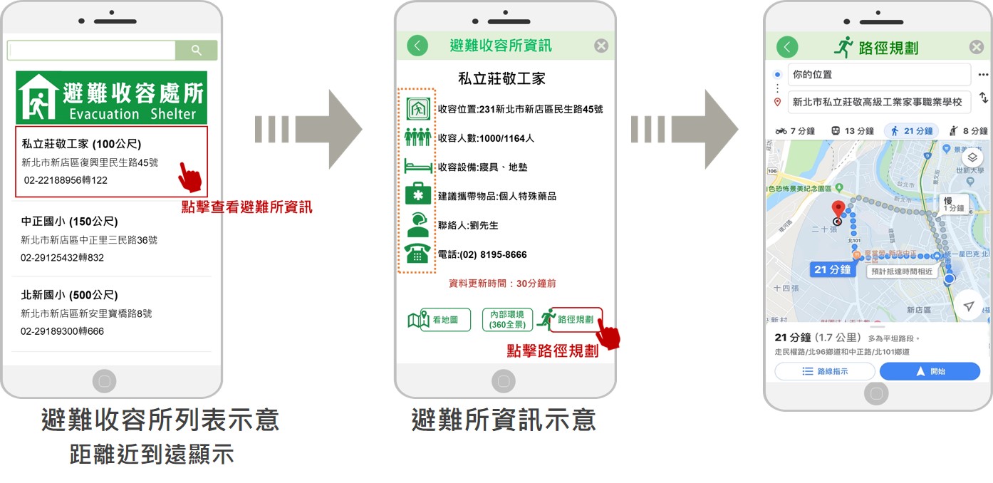
This system supports local governments in disaster planning by integrating twelve types of statistical data. It is used for querying historical events, estimating evacuated and sheltered people, calculating required shelter space, and assessing supplies in need based on age and regional characteristics. Additionally, the system allows users to search for shelter information and view results through map displays and downloadable data. |
| Scientific Breakthrough |
This system integrates data from twelve government departments to form an evaluation database, covering flood, landslide warnings, and historical typhoon information. It offers several functions, including querying historical evacuation and shelter statistics, estimating potential disaster-affected populations, forecasting evacuated and sheltered population, assessing the need of shelter space, and calculating required supplies quantities. Its key feature is providing precise data to assist local governments in disaster planning, optimizing evacuation and shelter decisions through historical data and model estimates. |
| Industrial Applicability |
This system provides disaster planning tools for local government disaster departments, integrating diverse data such as flood and landslide warnings and historical typhoon tracks. It features functions for querying historical data, estimating potential disaster-affected populations, and calculating need of shelter space and supplies, thereby enhancing the efficiency of disaster resource allocation and response decisions. The system is data-centric and includes extensive survey and statistical information, supporting academic research and advancing understanding of disaster management and social vulnerability issues. |


