| Summary |
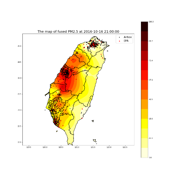
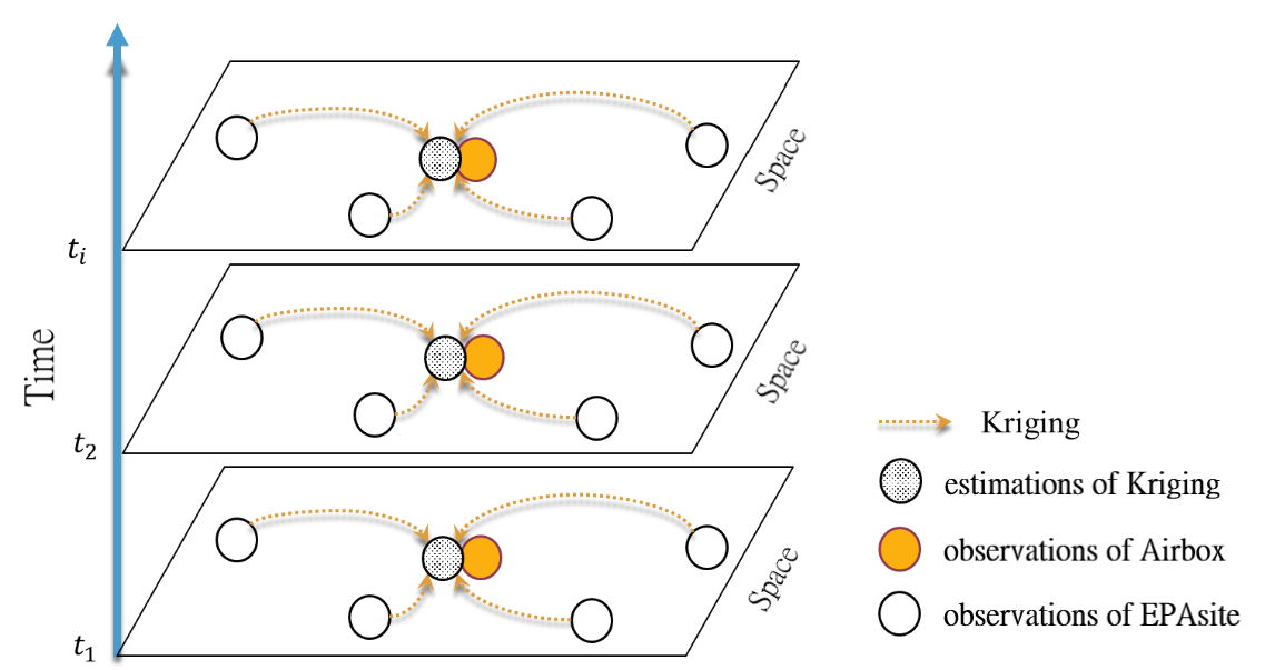
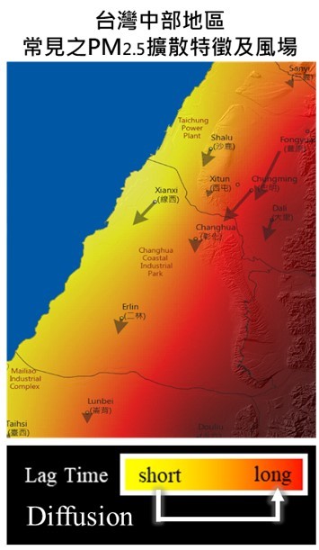
The study developed a set of research processes to extract the spatiotemporal mechanism of PM2.5. First, the multi-sensor spatiotemporal data fusion technology was generated to integrate heterogeneity data to improve the spatiotemporal resolution of PM2.5 estimation, which was based on the Optimum Linear Data Fusion theory and combined with a multi-time step Kriging method for spatiotemporal estimation. Next, we pioneered the PM2.5 diffusion feature extraction method, adopting Cross Wavelet Transform (XWT) combined with Principal Component Analysis (PCA) to extract the main PM2.5 diffusion patterns under the influence of daily weather variations. We adopted XWT to calculate the phase angle difference, which showed the lag time effect of PM2.5 in spatial, namely the diffusion situation, and then extracted the main spatiotemporal diffusion patterns through PCA. Finally, the study discussed the atmospheric factors and pollutant characteristics corresponding to each diffusion patterns. |
| Scientific Breakthrough |
The research integrated the IoT and spatiotemporal big data analysis technology to explore the PM2.5 spatiotemporal feature and physical mechanism. Without losing data quality, the spatiotemporal resolution of PM2.5 estimation was improved through innovative data fusion technology. Additionally, we pioneered to adopt signal analysis methods combined with machine learning methods to extract the main patterns of PM2.5 diffusion distribution. The atmospheric diffusion conditions, estimated by several weather factors, assisted to link the corresponding diffusion patterns under different weather conditions. The set of research processes is able to apply in other regions of Taiwan, and it is expected to establish Taiwan air pollution warning indicators based on atmospheric diffusion conditions. |
| Industrial Applicability |
The research integrates IoT, big data analysis, and GIS, and can be applied to the whole Taiwan or even the world. The set of research processes allows companies, government agencies, schools, and research institutes to present the users of visualized pollutant analysis results through various platforms. Additionally, the more effective scientific reference basis is provided to formulating air quality control policies, urban planning, assessment of health risk exposure, arrangement and development of microsensors, etc. |

